Special delivery: Sign up for the free Marlin email newsletter. Subscribe to Marlin magazine and get a year of highly collectible, keepsake editions – plus access to the digital edition and archives.
New products are the mainstay of any business. Engineers and product specialists working for marine industry companies live in the hamster wheel of churning out revised versions, full updates and completely new products for consumers to incorporate into their next build. This is good news for end users, but a tall task for those in the wheel who are always pursuing the next level and pushing to introduce the next big thing. Some recent advancements by recreational-navigation and fishing-technology companies have come from the commercial business units of these corporations, while others have trickled down from military uses.
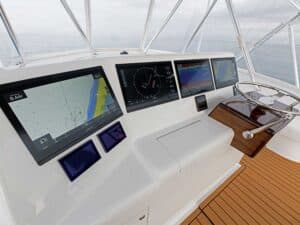
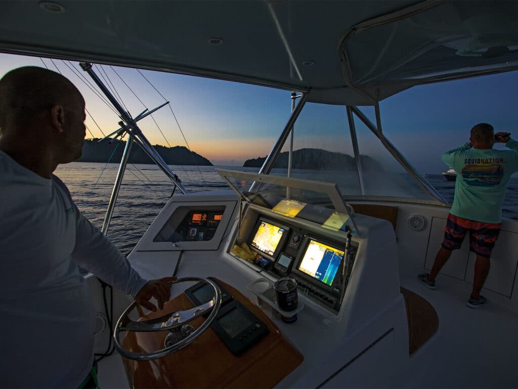
Walking on the bridge of a modern sport-fishing boat awakens the senses to a vast array of technologies to see ahead and around the boat with radar, under and around the boat through echosounder and sonar technology, and into the night sky with daylight clarity through night-vision systems. In other limited-visibility scenarios, AIS tells us what’s coming around the bend. Marine-sciences technology for fish finding via satellite now brings real-time data to the bridge, helping eliminate the big guess of where to put lines in the water. It’s always better to fish where they are, after all.
If you’re outfitting a new boat or doing a refit, take a look at some great new technology that should not be left unchecked.
Sirius Fish Mapping
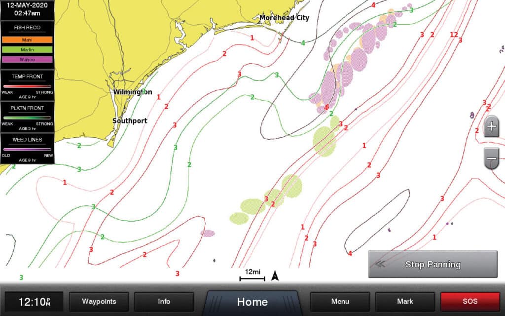
SiriusXM Marine works as a subscriber-based service covering southern Canada, the mainland US out to and including Bermuda, the Bahamas, the Gulf of Mexico including the Yucatan Peninsula and Cuba, and the majority of Mexico including all of the Baja peninsula and the mainland Pacific down to south of Puerto Vallarta. Compatible with all major brands of electronics, SiriusXM Marine weather is an invaluable tool when offshore for getting up-to-date weather. Combining the latest weather data from many private and government sources, SiriusXM puts reliable, timely information at your fingertips on your MFD screen.
SiriusXM Marine Fish Mapping’s newest introduction, Version 2, is an additional tool that provides regularly updated information on sea surface temperature contours, including breaks and their differences in strength, 30-meter subsurface seawater temperature readings, plankton concentrations and strengths, weed lines, and recommendations on where to fish—all displayed in layers on your screen. Version 2 of the Fish Mapping app brings all of this information to your smartphone or tablet, along with items only available on the app, including ocean currents, convergence zones showing either upwellings or downwellings, and where they meet to create rips or eddies, which often hold fish. It also features a measuring tool to determine distances from place to place, and a routing function for preplanning while away from the bridge, along with historical data from your time on the water.
Using the SiriusXM Fish Mapping app, you have the ability to see pertinent activity in your waters before heading out, allowing you to preplan your trip, narrowing down the best grounds to fish, which ultimately means saving time and fuel while catching more fish. All of this critical weather and fishing information can be bundled with the entire 150-channel SiriusXM entertainment catalog.

Night Vision
For years, we relied on radar (and continue to do so) for our night transit situational awareness. Radar provides a good look at targets around our navigational zone at sea while also painting markers when transiting a channel or inlet. The advent of light bars has helped significantly to see markers when maneuvering narrow channels. Companies such as Black Oak LED specialize in marine application products for boats of all sizes. Its variety of products feature spot, flood or both, depending on your application, to light up the night sky when transiting a shallow channel in the dark.
However, when offshore in the dead of night, the greatest technology to grace a skipper’s situational awareness is night vision. In its infancy the technology was pricey, often times grainy, and mostly black and white. But again, thanks to the hardworking engineers and techs, night vision has become affordable, intuitive and a reliable way to see the water in front of you as if transiting in daytime.
FLIR, with its proven thermal imaging, has become the leader in this area. Its M300 series is the most common on larger sport-fishing boats. The M364C, in particular, has become a popular choice. It blends details from a high-definition thermal imaging sensor, along with a high-definition low-light camera, allowing for color overlay to identify markers and other targets with greater accuracy. Its high-def, 1080-pixel, 30X zoom allows visibility farther than your eyes can see, even in daylight. More features include gyrostabilization and seamless integration with leading manufacturers’ MFDs.
Read Next: Navigation is Easy? Think Again
Not to be outdone, Sionyx—the personal night-vision manufacturer with solutions for hunters, outdoors enthusiasts and boaters—has introduced its Nightwave product for boats. Built around the company’s patented Black Silicon CMOS sensor, Nightwave offers affordability for smaller boats as well as a great backup system for larger boats. This non-thermal color camera offers extreme low-light capabilities with a 44-degree field of view, hardwiring or streaming capabilities to smartphones or tablets for those not at the helm, and flexible mounting options with seamless connection compatibility on all major brand MFDs.
These products are a long way from loran-A and -C, which I learned on when I started out. Technology has made everything about what we do better—especially for situational awareness. The hardest part is keeping up with the hamster wheel.
